
Oakdale ZIP Code Directory Coverage
The official Minnesota county and ZIP table identifies two ZIP codes for Oakdale in Washington County. The entries describe postal service coverage, not a city boundary or a list of Oakdale households. A useful search keeps three facts apart: the municipal jurisdiction from city or county geography, the property situs from address and parcel records, and the postal city and ZIP used for delivery.
| ZIP | Areas | Post office | Notes |
|---|---|---|---|
| 55042 | Oakdale addresses sharing this postal area | Lake Elmo postal label in some datasets | Confirm the specific address with USPS; a Lake Elmo label does not establish municipal location |
| 55128 | Oakdale plus shared postal-service area | Saint Paul postal label in some datasets | Also serves Oakdale, Landfall, and Pine Springs; retain municipality separately |
The Minnesota County and ZIP Codes table, revised in January 2019, supplies the official Oakdale entries. Research found no separate Oakdale-only ZIP, PO Box-only ZIP, or verified third ZIP. A row that has not been located should remain unverified rather than being filled with a nearby postal code.
Oakdale ZIP Code Postal Labels
ZIP 55042 may carry Lake Elmo as its recognized postal city in some postal datasets, even where an address is in Oakdale. ZIP 55128 may carry Saint Paul and serves an area that includes Oakdale, Landfall, and Pine Springs. Neither presentation overrides the city boundary. For a property question, the county parcel and city address records identify the situs and municipality; for a mailing question, USPS identifies the delivery form.
That separation is especially useful when sorting a shared ZIP. An Oakdale address with a Lake Elmo or Saint Paul postal label is not automatically outside Oakdale, and a matching ZIP on a nearby address does not automatically place it inside the city. Preserve postal ZIP, postal city, situs address, parcel identifier, and municipality as separate fields. This small discipline avoids turning a postal convention into a claim about a resident or a jurisdiction.
USPS Checks for Oakdale ZIP Codes
USPS ZIP Code Lookup has three relevant modes: find a ZIP by address, find ZIP codes by city and state, and find recognized city names by ZIP. Address mode accepts street address, city, state, an optional apartment, suite, or other field, and ZIP. City and state mode is helpful for browsing postal coverage, while ZIP-to-city mode tests the names USPS recognizes for a code.
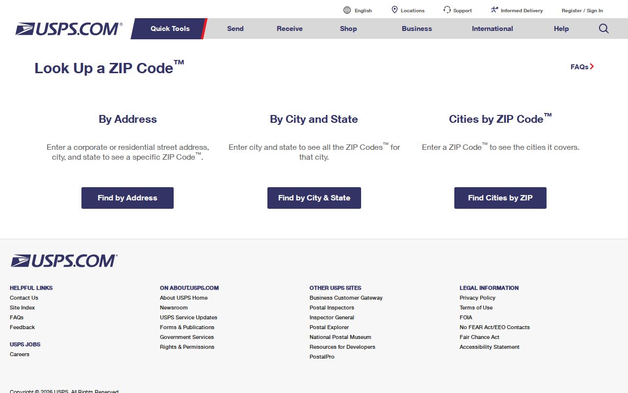
USPS uses this form for a delivery check, not a resident finder. USPS warns that a ZIP result does not confirm a person or company at an address. Use it to standardize a mailing address, then turn to municipal GIS or the county parcel record for geographic context.
| Field or mode | Use | Input or result note |
|---|---|---|
| Street address | Find ZIP by address | Use the physical delivery address, then compare the returned postal form |
| City and state | Find ZIP by address or browse by city/state | Postal city can differ from the municipal city |
| Apartment, suite, or other | Optional address refinement | Add only where the delivery address requires it |
| ZIP | Address lookup or ZIP-to-city lookup | Tests postal presentation, not property occupancy or city limits |
Oakdale Address Fields and ZIP Checks
The Oakdale address-point layer carries situs address and ZIP fields alongside legal and parcel-related information. That makes it a useful location cross-check after a USPS result. The Washington County property lookup is keyed to PIN or Property Address, not a ZIP-only resident search, so it is best used after the exact location is known. A parcel record can link an address to a PIN, ownership or tax fields, and assessment context, but none of those fields proves current occupancy.
Start with Oakdale Maps and GIS or the county's property lookup to retain the municipality and parcel context. The physical location then remains distinct from the USPS delivery label. This is the appropriate cross-check when a ZIP covers more than one city or when a historic source uses a different place name.
For a current address, first enter the complete delivery form in USPS, including the unit when it is part of the mailing address. Next, compare the returned ZIP and postal city with the Oakdale address-point result. If the location is in the city, note the situs address and ZIP from that layer, then use the county property lookup with the Property Address or PIN. This sequence keeps the USPS answer in its proper role: it standardizes mail delivery, while the city and county layers establish geographic and parcel context.
A street name that does not resolve cleanly needs an additional check, not a guessed ZIP. Try the current street spelling, then a documented alias, and compare the parcel legal description when the record is old. Save the source date because postal labels, municipal layers, and tax records update on different schedules. Where the city and postal result differ, report both facts plainly. The distinction matters for Oakdale because the shared 55042 and 55128 coverage makes a postal-city match too broad to answer a municipal question by itself.
Finding Oakdale Residents by ZIP Code
A ZIP is a first-pass geographic filter, not a ZIP-wide resident list. Work from a real address or parcel first. The MNVotes form uses a ZIP or county plus city or township, house number, street, and identifying fields to check one registration match. It does not provide an unrestricted ZIP roster, and Minnesota voter-list use is limited by statute.
- Use USPS address mode to confirm the postal ZIP and recognized delivery presentation for the complete address.
- Cross-check the street location in Oakdale GIS and retain the situs address, ZIP, parcel relationship, and municipal result.
- Search Washington County property data by PIN or Property Address when a parcel cross-check is needed. Keep owner or tax mailing information separate from occupancy.
- For a person-specific registration question, use MNVotes with the person's required name, date of birth, ZIP or county, and address fields. A result confirms only the registration status shown at that time.
Once the street is necessary, use the Oakdale street directory for the fuller address-by-address record path. A ZIP alone should not replace a precise street, unit, or parcel identifier.
ZIP Code Boundaries and Oakdale City Limits
Oakdale's 2024 community survey report says its vendor used USPS listings but removed out-of-city addresses with the municipal boundary. That is direct local evidence that the ZIPs serving Oakdale reach beyond the city. Minnesota demographic guidance likewise cautions that ZIP codes and ZIP Code Tabulation Areas do not reliably line up with municipal or county boundaries.
Use the city boundary and parcel location for a municipal question. Use the postal label for delivery. A shared ZIP may be useful for organizing research, but it is not evidence that every address, owner, voter, organization, or historical record in that ZIP belongs to Oakdale.
Postal and municipal facts differ. A Lake Elmo or Saint Paul mailing label can be valid for an Oakdale address. Verify the street in GIS or parcel data before assigning municipal geography.
Historic Oakdale Postal Name Clues
Older records may name Oakdale Township, Bass Lake Station, Lohmanville, Halfway House, or Lake Elmo instead of the modern city. Those labels can point to the same broad local history without resolving to a modern ZIP. Pair the year of the record with a plat, deed, newspaper, or Washington County Historical Society source before assigning current postal geography to an older address.
Street aliases deserve the same care. Oakdale Ordinance 920 renamed Healy Avenue and Lane North to Heath Avenue and Lane North. Postal databases can lag or accept both forms, so compare the old spelling with the current address point and parcel legal description. No official historical ZIP-boundary or USPS realignment chronology for Oakdale was verified, which means a dated mailing question needs contemporaneous evidence rather than a current ZIP result.
Oakdale ZIP Code Terms to Keep Separate
Postal terms describe how mail is organized. They should not be used as shortcuts for city residency, property ownership, or a person's location. The definitions below help keep an Oakdale ZIP code search focused on the question the record can answer.
- ZIP and ZIP+4
- A ZIP identifies a delivery area. ZIP+4 adds a smaller delivery segment to improve routing for a particular address or range.
- PO Box ZIP
- A ZIP used for post-office box delivery rather than ordinary street delivery. No Oakdale-only PO Box ZIP was verified in the research.
- Unique ZIP
- A ZIP assigned to a single large organization or institution. No verified unique Oakdale ZIP was located.
- Carrier route
- A postal delivery grouping within a ZIP. It helps route mail but does not define a city boundary or confirm a resident.
Oakdale ZIP Code Research Limits
A clean negative result should say what was tested: the portal, address form, ZIP, date, and known coverage limitation. A USPS result cannot verify a person or company. A county property record is address or PIN based and does not prove occupancy. MNVotes needs identifying inputs and reflects registration information, not a ZIP-wide list. These boundaries are part of an accurate result, not a reason to infer more than the official source shows.
For a historic mailing question, retain the original envelope, directory, newspaper notice, or dated record alongside the current USPS result. For a present-day municipal question, retain the parcel or GIS source date. When the address carries a safety concern or a substitute-address indication, stop rather than attempting to reconstruct a protected location.
Note: A ZIP can help discover a place, but the address, parcel, postal label, and municipal boundary each require their own confirmation.